|
|
 |

The general goal of MAP:GAC in Colombia is to generate geoscientific information and to transfer knowledge on the geological aspects and geoenvironmental hazards to the organizations in charge of decision making as well as the community, with the aim of promoting socioeconomic development, and improving the quality of life of Colombians living in the studied regions. The specific objectives are to increase knowledge in themes related to evaluation processes of geological hazards as well as human-induced hazards; the integration of information and dissemination of knowledge for the benefit of the government and the general public; and the articulation of information in decision making and land use planning and development in the working areas.
The activities are grouped in the following subprojects:
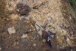
Evaluation of seismic hazards at the Colombia-Venezuela frontier. INGEOMINAS has advanced in the documentation and implementation of a structural and neotectonic database. In addition, a preliminary report of the historical seismicity and a catalogue of measured seismicity have been produced for revision and integration.
Investigation and zonification of geoenvironmental effects by classification of subsoil in the Eje Cafetero. INGEOMINAS has made an inventory of geoscientific information and planning in the study zone, and is reviewing the documents that display preliminary methodological proposals for the evaluation of geoenvironmental effects.
Dissemination of geoscientific information of working areas in a SIRE system. INGEOMINAS signed an agreement with the Centre for Prevention and Emergency Attention of the Capital District (Bogota), for the implementation of a SIRE system in the Institute. SIRE is an information system for the management of risks and and response to emergencies.
Strengthening the communication and interaction of scientists and technicians with authorities and communities for effective action in Risk Management. This is a very important aspect of the project and it will begin once we have concrete results from the previous subprojects.
|

|
|
 |
|